
ATHENS COUNTY, Ohio — When the Federal Emergency Management Agency released updated flood maps for parts of Athens County last year, it had a ripple effect on construction projects from unincorporated communities to Ohio University’s campus.
FEMA’s flood maps impact communities participating in the National Flood Insurance Program, which offers subsidized flood insurance to residents. Both the city of Athens and Athens County participate in the NFIP, as do Nelsonville and most villages in the county.
To be eligible for the federal flood insurance program, participating communities must enforce federal regulations around construction and development in the most flood-prone areas, known as Special Flood Hazard Areas. Failure to comply with those regulations can lead to a community being dropped from the program — as Chauncey was in 2009.
OU and Athens: Building up
OU’s Associate Vice President for Design and Construction, John Cozad, and his team have been working from the new flood maps since 2022, when projected changes were made public.
“Since that point in time, we’ve been using those as not the actual elevations, but designing to meet those elevations,” Cozad said.
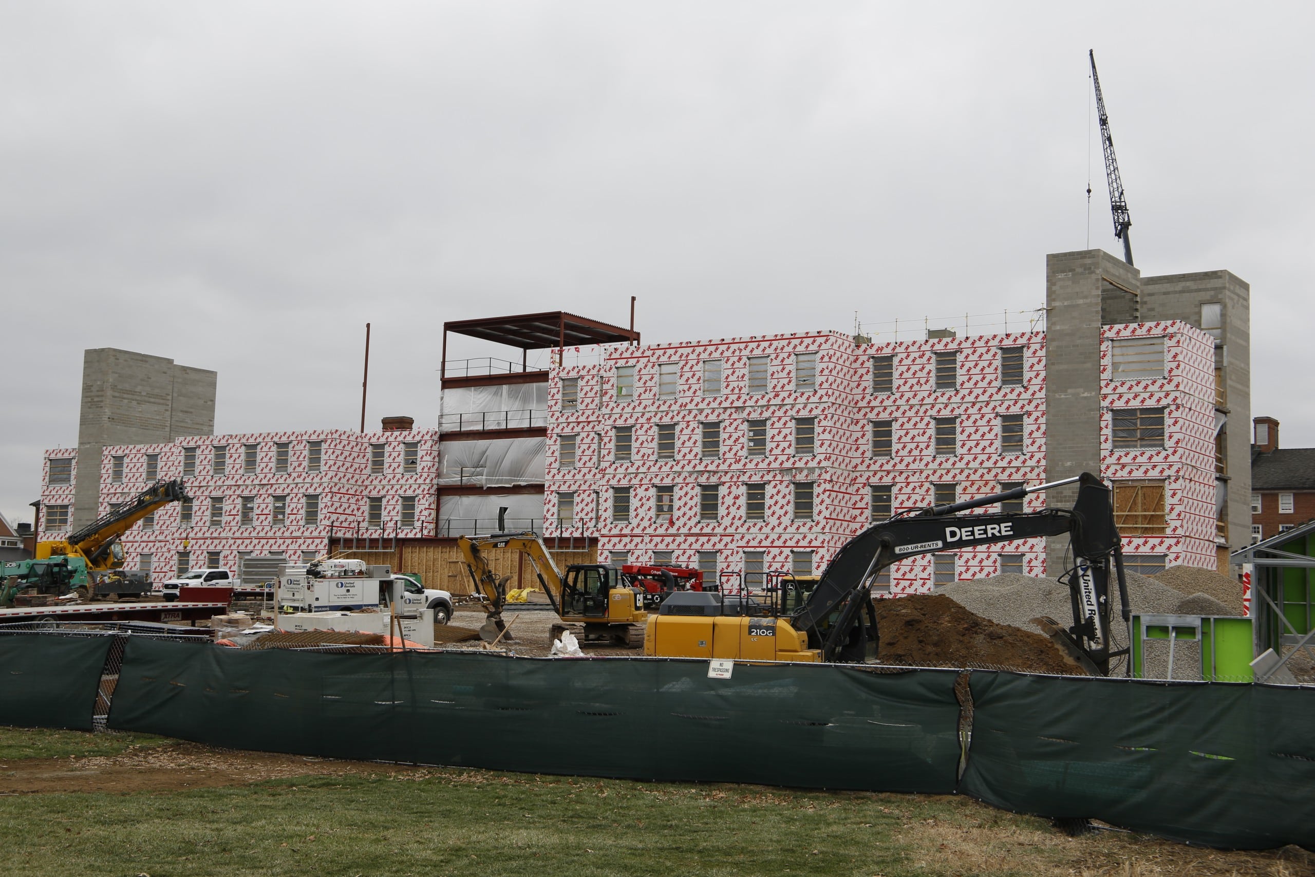
OU is constructing a new dormitory, McDavis Hall, on South Green behind Crawford, Brown and McKinley Halls. To comply with building regulations under the new maps, OU added 10 feet of fill on the site and compacted it, raising the new building out of the floodplain.
“It looks like it’s built on a mountain of dirt,” Cozad said.
Part of the building — a ground floor multipurpose room with bathrooms to serve the nearby recreation fields — will still be in the flood plain. According to Cozad, this room will have non-critical infrastructure and can withstand potential flood conditions.
In addition to raising McDavis residence hall, South Green’s topography also saw the iconic catwalks removed as part of recent construction efforts. The catwalks served several purposes, as a quick entrance to the dorms, as a utility bridge for maintenance and as a way to get across south green when flooding blocked off ground access.
Elevated pathways will still be part of south green however, as a small bridge will connect McDavis hall to the “front four” dorms that are also elevated out of the flood plain.
Other Ohio University buildings, such as the newly renovated Clippinger Laboratories will see its lowest level be used as storage as part of flood proofing efforts.
“For an existing building that has occupied space in the flood plain, there’s nothing that requires us to change [how we use it],” Cozad said. “But as a matter of best practice, when we have the opportunity, we’re getting people and expensive assets out of those areas that are within the one percent flood elevation.”
Larry Wines, the director of enterprise risk management and insurance at Ohio University, said that the University’s insurance is unlikely to change as a result of the new flood maps.
“The University does not anticipate any immediate changes to its existing insurance agreement as a result of the FEMA’s recent flood map updates,” Wines said.
Like OU, the city of Athens raised its new fire headquarters, located on Stimson Avenue, to get it out of the flood plain.
“The new firehouse was built above the 500 year floodplain, so the maps do not affect it at all. The ground was raised to build it above that level,” Andy Stone, the city service-safety director for the city of Athens, wrote in an email to the Independent.

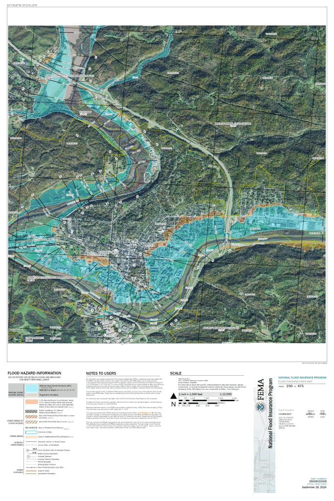
Outside of the elevation changes, David Riggs, code director for the city of Athens, said that improved hydrological and topographical data resulted in the new maps more accurately reflecting the flood plain.
“Very roughly, the City now has a decrease in the predicted floodplain areas on the north end of Hocking River and an increase in the predicted floodplain areas in the south and east end of the Hocking River,” Riggs wrote in an email to the Independent.
Rural Athens County
Connor LaVelle, the Athens County planner and floodplain administrator, sees his role as one of safety, protecting both people and property.
Part of LaVelle’s job is to issue and verify permits for construction occurring in the flood plain. Many already existing buildings were grandfathered in for permitting purposes when the maps were first developed by FEMA, but new construction such as renovations, a new deck, barnbuilding or extensive brush clearing on these properties requires a permit.
Even the common tactic of laying down a layer of dirt to get up out of the flood plain will require that a permit be issued by the flood plain administrator.
“You need a permit for development, and development pretty much means any kind of man made activity that’s changing the landscape of that piece of real estate,” LaVelle said. “So adding fill is probably going to get you out of the flood plain, but we need more information, we need to know what kind of fill it is.”
For LaVelle his biggest challenge as a flood plain administrator is a lack of awareness surrounding property near or in the flood plain.
“I think that the challenge sometimes is just knowing [whether] your property is or isn’t in a flood plain, especially with some of the other creeks and areas that aren’t just the Hocking River,” LaVelle said.
Lavelle added on that, while the new flood maps are very helpful, there are still parts of Athens County with no maps at all, or maps that don’t differentiate between the floodway — an area very likely to flood with extra protections — and the flood plain — an area with a chance of flooding that often contains buildings.
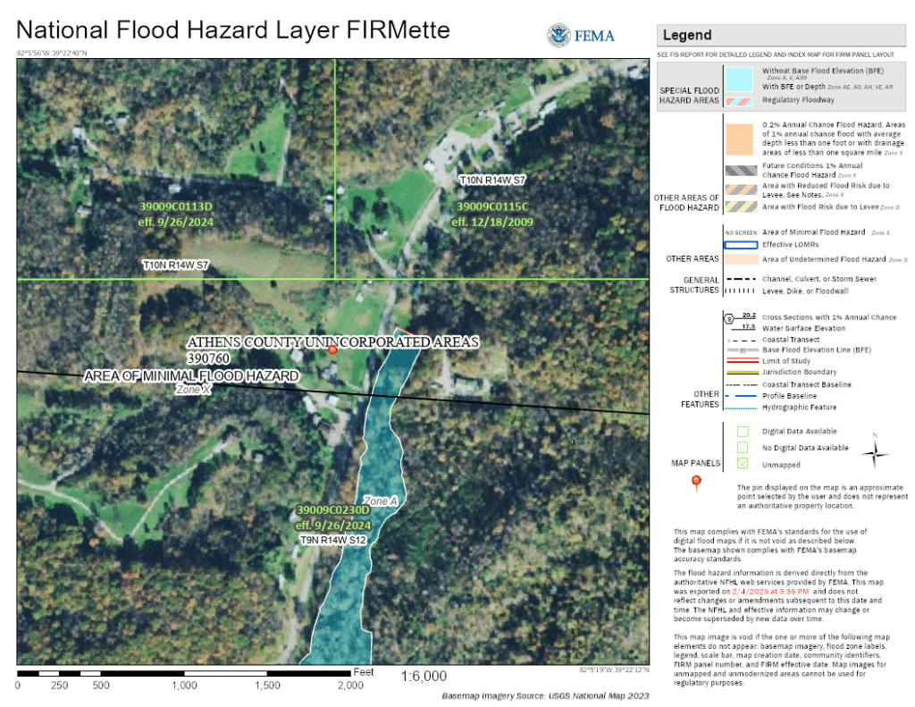
“I guess the way to think about that is, you know, with the Hocking River … you have a very delineated floodway that has tighter rules and regulations,” LaVelle said. “Then you have other bodies of water, like the creeks that we have: Margaret’s Creek, Sunday Creek, Monday Creek. [Parts of those] areas that don’t have a delineated floodway. They just have a [flood hazard area] and that has this sort of flexibility. It becomes difficult, because in my role, you want to make sure that you’re not going to make any kind of negative effects to the body of water or put your property at risk.”
Lavelle said his ultimate goal as flood plain administrator is to find a balance between development and the waterways.
“It’s not that we want to discourage development, but it’s just that we want to encourage the right kind of development,” LaVelle said. “I think that you can sort of do it in a way that you can coexist peacefully between human beings’ actions and then the natural floodplain.”
Editors Note: This story was updated to fix misplaced punction and correct formatting mistakes