ATHENS COUNTY, Ohio — Wherever you are in Athens County, odds are you’re close to multiple sites of historical significance featured on a new, interactive online map of images curated by Ohio University Libraries Digital Initiatives.
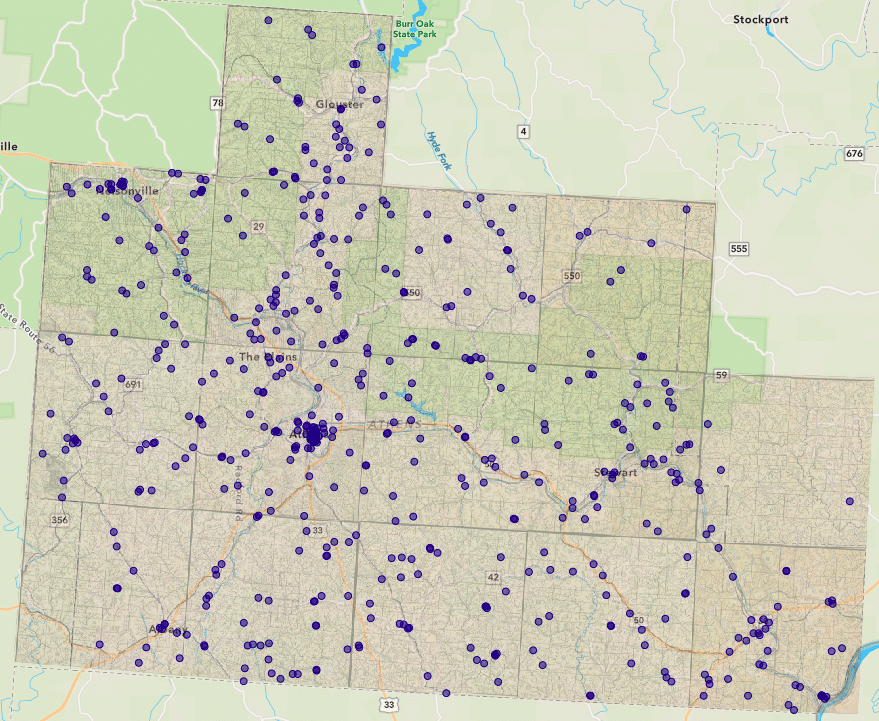
The online map is part of a broader exhibition, “Mapping the Historical Range Books of W. E. Peters,” which features images from more than 600 sites of historical significance to Athens County.
Sarah Romer, an OU senior who worked intensively over the past year to help prepare the exhibition, said she hopes the online map encourages people to visit and remember historical sites.
“I really hope people get excited about it and treat it like an adventure or a scavenger hunt — something you can go out and do with your friends,” she said. “And, I hope that members of the community in Athens County can connect to the past a little bit … and that it reminds them of what’s been here and what’s still here.”
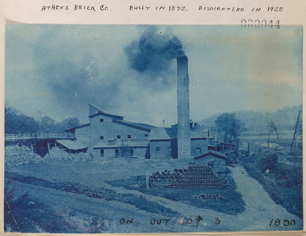
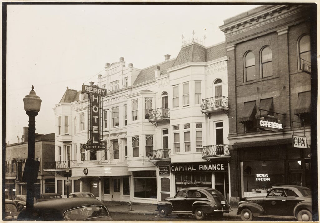
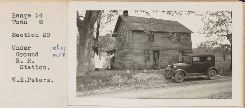
William E. Peters, a coal mine engineer and land surveyor, photographed many of the sites in the 1930s and 1940s and compiled his and other images in scrapbooks known as his range books.
Peters documented the sites — which include family cemeteries, Native American earthworks, covered bridges and more — because he believed they were in danger of neglect or removal, according to the exhibition website.
Exhibition curator Erin Wilson, a digital imaging specialist and lab manager working with preservation and digital initiatives at OU’s Mahn Center for Archives and Special Collections, said many of the sites remain in Athens County to this day, while others have been removed or destroyed.
Mapping the sites and images online makes Peters’s 26 range books, each over 100 pages, more accessible to both researchers and the public, Wilson said.
“It’s really hard to engage with [the full range books] as a researcher, or just as a casual reader, especially if you’re looking for specific geographic places, which most people are when they’re looking at this collection,” Wilson said. “The map is intended to be a visualization, and a way to graphically place the density of material in the range books.”
Not all of the features Peters documented are mapped online, however.
Specifically, the map omits most of the 72 Native American earthworks Peters documented “because there is such a history of looting and grave robberies… that we probably shouldn’t publish that information in the interest of protecting them from further desecration,” Wilson said.

Preparing the exhibition required multiple years of labor. Wilson said she first saw the collection when she interviewed at OU in 2019, and the project kicked into high gear the next year.
After digitizing the collection, Wilson saw the potential to put the collection in a contemporary context through geolocation and mapping, she said.
She then hired several students, including Romer, who was fully dedicated to the project.
Romer said the project allowed her to use experience with mapping she has gained through her wildlife and conservation biology major while connecting her more deeply to Athens County and its history.
Additionally, the project helped her become a better researcher, she said.
To help map the various locations in the range books, Romer said she pored through Google Maps, church history pages, local Facebook groups where members discuss their community’s history, census tract records and more.
Ultimately, Romer and the rest of Wilson’s team were unable to identify exact locations for every site. But an online community submission tool could help pinpoint more features.
The community submission tool allows users to submit comments about or images of the sites Peters documented.
Wilson said she views the online map and community submissions as “almost like a continuation of what [Peters] started.”
“The real focus of the [exhibition] has been documenting change through time — and that’s what Peters was doing,” Wilson said. “He saw an incredible amount of change, living here from the 1880s to 1952 when he passed, and clearly he was documenting things he knew were in danger of disappearing…
“I feel like it’s a good way for us to carry on his legacy, to follow up and document what’s here today, because it will be gone possibly in the future as well.”
Along with maps he drafted by hand, the range books are on display in an in-person exhibition on the fifth floor of OU’s Alden Library, open until May 5, Wilson said.